
The challenges and potential for urban and peri-urban agriculture in Belém
On the islands, on the continent, in schools, in health units, or in the backyards of houses. Açaí, cocoa, manioc, vegetables, and medicinal plants. Family and community-based. For commercialization and self-consumption. Agriculture is present in several ways in the capital of Pará, northern Brazil.


2 Did you know?
The urban and peri-urban
agriculture in Belém has the potential to supply vegetables
and greens for
1.7 million
people.
This exceeds the entire
population of Belém (1.5 million)!
It can also
supply over
950,000
people
with açaí beverages
per year…
and generate
3,267
jobs.
89%
of the agriculture and
livestock farms in Belém
are family-managed.
11%
of the people of the Belém Metropolitan Area
(BMA) buy their food at city fairs. In the
rest of Brazil, this number reaches only 4%.
80%
of foods
marketed at CEASA
of Pará proceed
from other states.

Food and
the territory
What is the relationship between food and urban territory?
Explore the image to access the data and understand the configuration of relations between production, supply, marketing, consumption and institutions that make up the urban food system in Belém and region.


Urban and Peri-urban
Agriculture in Belém
In this section, we will take a closer look at the agriculture practiced in the capital of Pará, whether urban (conducted within the urbanized area) or peri-urban (in the more distant and less urbanized regions in the city outskirts). The data proceed from the agricultural census and mapping of farming experiences conducted in loco for the present study.

Photo: Moisés Savian/ Acervo Instituto Escolhas

The Agricultural and Livestock Census of 2017 (IBGE) identified 601 establishments in Belém:
farms according to their size in hectares (ha)
{{cada.name}}

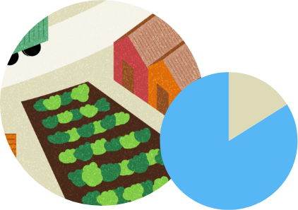
of the farms have an area
under 20 hectares.
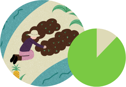
of the farms are
operated by families.
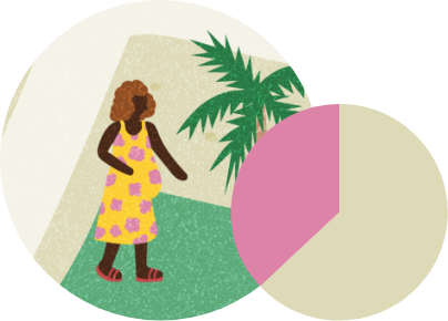
of the farms are headed by women, above the figure for the state (20%) and country (17%).

of the establishments produce açaí, 53% of which is cultivated and 16% is obtained by extractivism.*
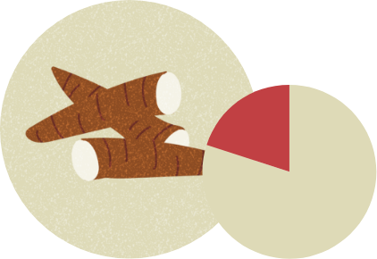
of establishments
produce cassava.

of animal production, found
in 12% of the establishments.

products are chives, cabbage, caruru,
lettuce, chicory and parsley.

projects linked to the
National Program for
Land Reform.
Complementarily, the survey produced a visual mapping, through geoprocessing and satellite image analyses of the agricultural areas in the municipality, producing 163 polygons with a total area of 235.2 hectares.
These areas, as well as the establishments in the agricultural census, can be seen in our interactive map.
Types of Agriculture
in Belém
An essential aspect to be observed in Belem’s relationship with food production is the location of the productive land: in the floodplain areas – susceptible to periodic flooding – extractivism and forest management prevail. On dry land, horticulture, temporary crops and cultivated açaí stand out. The study identified eight types of agriculture in Belém.


Urban Agriculture
Case Studies
Here, you will find analyses of the economic and financial viability of some types of urban and peri-urban agriculture initiatives in Belém, selected according to their geographic location, diversity and production system, among other criteria.


Interactive map

Land Use
?Identification of land use classes (native vegetation, water, agriculture and urbanization) elaborated in this study from high resolution images of the year 2020 obtained from the National Institute for Space Research. Available at: http://www.dgi.inpe.br/CDSR/
Environmental areas and settlements
Urban and peri-urban agriculture
Agriculture and Livestock Establishments
Georeferencing of the establishments, according to the Agricultural Census of 2017 by IBGE.
Agricultural polygons
Georeferencing of the agricultural polygons mapped by the study from satellite images using visual markers.
Food Supply and Marketing
Public establishments
?Georeferencing based on data of 2022 made available by the Municipal Secretariat of Economy / Department of Fairs and Markets and Municipal Secretariat of Education and Culture / Sectorial Planning Center. For more information, download the georeferenced data in the Credits section.
Privately owned establishments
?Distribution of establishments that sell fresh, mixed, and ultra-processed products in the territory, according to the resident population.
Analysis carried out based on the classification of commercial establishments listed in the 2019 Annual Social Information Report, according to the criteria proposed in the 2018 “Technical Study: Mapping Food Deserts in Brazil” (available at https://bit.ly/MapeamentoDesertos).
The establishments classified in the fresh/mixed or ultra-processed products were geo-referenced based on the postal code (CEP) (information available in RAIS), located in the territory by means of Google’s API (geolocation) and aggregated into a 1 km hexagonal grid.
The total number of establishments was divided by the resident population in each grid, obtained by extrapolation of the 2010 Census of the census sectors, using a scale of 5,000 inhabitants.

Next Stop: Belém of the
sustainable urban agriculture
What is the urban agricultural potential in Belém when produced using sustainable techniques? In which spaces can the potential be developed? How many people are possible to be fed? In this section, you will find the data that answer these questions.
One of the steps to foment agriculture in cities is to identify adequate areas for development of the activity. Undeveloped areas, unused or underused land, without forest cover, can potentially be dedicated to urban agriculture. With this in mind, the study mapped 699 polygons of public or private areas in Belém, which could be occupied for food production. These areas, totaling the equivalent of 1,170 hectares, are shown in the map at the side.
The allocation of part of these spaces for agricultural production, together with the improvement of production in areas of the city where food is already being grown, served as a basis for the simulation of two scenarios, which used different sustainable production models to explore the potential of urban and peri-urban agriculture in Belém. Check out the results below.

Potential Spaces
Non-developed areas and non-used or underused areas, without forest cover, can potentially be dedicated to urban agriculture.

2 Sustainable urban agricultural models for Belém
Model A - Agricultural lot
Model B - Multiple activity lot
Intensive occupation of potential spaces for urban agriculture
Increase the productivity of biodiverse systems
Onshore
Floodplain
0.5 hectare
5 hectares
Vegetables (protected cultivation) and cassava
Açaí (managed with minimum impact)
2 full-time people
Day workers
Suitable for organic production, with permanent demand for seeds, fertilization and phytosanitary treatment.
Not used
Ranging from BRL 13,000 to 107,000 (considering the purchase of a utility vehicle in the highest investment scenario)
BRL 9,360.18/hectare
All year
See details of this model here
What is the potential
for urban and peri-urban
agriculture in Belém?
This section presents the simulation results of two scenarios that considered both the occupation of the mapped spaces with potential for urban agriculture in Belém and improvement of productivity in the areas already occupied by agriculture.
Scenario 1
Implementation
of Model A
Characteristics of the considered area
Empty spaces in Belém with areas exceeding 5,000 m², equivalent to 47.6% of the total mapped areas, and temporary tillage areas.
Total simulated area
344 hectares

Vegetables
and cassava

19,405
t/yr

people
per year*

1,376
persons
Scenario 2
Implementation
of Model B
Characteristics of the considered area
Areas with agricultural establishments where açaí production already occurs (permanent crops and extractivism) and areas of agricultural establishments that are not yet managed for açaí production.
Total simulated area
5,348 hectares
Açaí

30,431
t/yr

people per
year*
of the population
of Belém

1,891
persons
Food security in economically
vulnerable neighborhoods
In the neighborhood of Tenoné, located in the district of Icoaraci,
48 hectares of potential areas
for urban agriculture
were mapped. If they were occupied with productive units in the Agricultural Lot model, it would be possible to produce
2,683 tons of food per year, enabling supplying 230,000 people and generating employment and income for 191 people.
Currently, the district has almost 6 thousand families registered in the CadÚnico (unified register of poor families) to access social assistance policies, among them, income policies and access to food, with direct impact on food security.

11 actions to promote sustainable
urban agriculture in Belém
Photo: Moisés Savian/ Acervo Instituto Escolhas

Promote access of farmers in the municipality to technical assistance, with the objective of increasing productivity and improving the productive systems, the management and commercialization of the activity.
Promote land legalization and environmental compliance of agricultural establishments already in operation.
Stimulate concessions of public areas without destination or use for urban agriculture.
Articulate state and federal government agencies to guarantee access by Belém's farmers to technical assistance, credit and other policies.
Promote, in partnership with various public and private institutions, the training and mobilization of farmers in the municipality for cooperativism and the organization of productive chains, as a mean to facilitate the marketing of food and obtention of inputs and equipment for the productive process.
Promote policies to support the flow of urban agriculture products from the islands to the continent, via river transport.
Promote policies to stimulate the purchase of food from urban agriculture by restaurants, grocery stores and supermarkets in the municipality, promoting short marketing circuits.
Stimulate the recognition and certification of organic and agroecological production in the municipality.
Promote the acquisition of food from urban agriculture through the municipality's institutional purchases (schools, hospitals, popular restaurants).
Create a Municipal Inspection Service (SIM) that enables to adjust and add value to local production.
Include urban and peri-urban agriculture in the municipal overall plan, an instrument for territorial planning and land use regulation.
Method
The survey methods applied were inspired by the study “Closer than you think: the challenges for food production in the metropolis of São Paulo – Executive Summary”, issued by Instituto Escolhas in 2020.
From the geographic clipping of the city of Belém and its metropolitan region, a broad survey of available secondary data on production, commercialization and consumption relations that characterize the regional urban food system was conducted. The data was analyzed, processed and presented in a descriptive way and, where possible, georeferenced.
The agricultural practices conducted in the city of Belém where object of the detailed analysis, mobilizing primary and secondary data (collected by the research team dedicated to the study), regarding quantities and quality. The study also structured a typology of the agriculture practiced in Belém, from which five cases were selected for application of economic-financial analysis models.
The results of the economic-financial analysis enabled the elaboration of hypothetical models of productive units and simulate the potential for food production and job creation in the territory of Belém. The simulation counted on georeferenced data of the city’s empty spaces.
All data collected by the study, as well as additional information about the methodology and the referential used, are available at the links below (Portuguese only):
Complete Report Part 1 Complete Report Part 2

The challenges and potential of urban and peri-urban agriculture in Belém
Study conceived by Instituto Escolhas.
Overall Coordination – Instituto Escolhas
Jaqueline Ferreira, Camilla Guimarães and Vitória Leão
Research Teams
Food System Analysis: Osvaldo Aly Jr., Fernando Gaiger Silveira, Bernardo Campolina and Alan Nunes Araújo.
Analysis of urban and peri-urban agriculture: Moisés Savian, Sheryle Santos Hamid and Caio Cezar Ferreira de Souza.
Mapping of institutions: Ciria Rosa.
Georeferencing of establishments: Carolina Passos.
Design and development
FIB – Fábrica de Ideias Brasileiras (Brazilian Factory of Ideas)
Text Editing
Cinthia Sento Sé and Jaqueline Ferreira
Text Revision
Luisa Ghidotti
How to Mention
Instituto Escolhas. The challenges and potential of urban and peri-urban agriculture in Belém. São Paulo: 2022.

Model A - Agricultural lot
In this first simulation, the area would be used for horticulture, of which 20% (1,000 m2) would receive protected cultivation with the use of low tunnels, to ensure the production of greens even in the rainy season. Another 1,000 m2 would be employed for a cyclical crop – in this case cassava – with the objective of reducing the intensity of daily labor, making it possible for only two people working full time to manage the lot.
Three commercialization and coordination scenarios were considered for this model: direct sale to the consumers at the lot; wholesale and trade at fairs. The economic analysis indicates that the best scenario is direct commercialization at the fairs (retail farmer), followed by wholesale – which, however, requires greater initial investment and longer payback time. This result could be optimized by sharing the marketing structure with other farmers.


All simulated scenarios demonstrate the models´ economic viability, with their application depending on public policies of access to credit and technical support. For the scenarios in which the farmer approaches the market, financing is essential to enable acquisition of a utility vehicle. In the retail farmer scenario, municipal planning and availability of adequate spaces for the farmers to participate at market fairs are important.

Model B - Multiple activity lot
The proposition of this model is to intensify the production of açaí in areas of agroforestry systems with adoption of minimum environmental impact techniques in the native açaí plantations; applying the method created by EMBRAPA (refer to the technical report for further details).
The introduction of this management technology foresees the adequate combination of different tree types, açaí and other palm trees, throughout the area, to avoid competition for sunlight among them and guarantee biodiversity maintenance. The technique can extend the harvesting period from two to seven months throughout the year and generate an 8.4 t/ha production increase, considering that the average productivity is less than one ton per hectare in Belém. The costs for implementation and maintenance of the model are linked, mainly, to labor necessities. Marketing occurs directly to marketers and açaí preparers, considering a market with easy entry and outflow.
If combined with technical support and rural credit, minimum impact management can generate even more significant gains to produce this fundamental product for the food culture of Belém.

Research institutions

Get to know some institutions that develop research and extension projects about the food system in Belém and surrounding region as well as regarding the urban and peri-urban agriculture in the city.
Brazilian Agricultural Research Company
Amazon Family Agriculture Institution of the Federal University of Pará (UFPA)
Federal Rural University of Amazonia

Government
Several public authorities act and influence the relations regarding food production, marketing and consumption in the city of Belém. Check them out.
Food Supply Center of the State of Pará.
Belém Metropolitan Area Development Company
Coordination of Food Security and Nutrition Policies
Municipal Tourism Coordination
Health Surveillance Department
Brazilian Company for Technical Assistance and Rural Extension
Bosque School Foundation
Student Assistance Foundation
Pope John XXIII Foundation
Institute for Forestry and Biodiversity Development of the State of Pará
State Secretariat of Agricultural and Fishery Development
Municipal Health Secretariat
Municipal Secretariat of Economy
Municipal Secretariat of Education

Companies
In the definition of their business strategies, companies can play an important role in shaping more sustainable food systems. This study mapped out some companies of the private sector involved in such activities:
Combu´s daughter
Iacitatá Restaurant
See the fruit
Green Citizen

Organizations of the Civil Society
In Belém and its peri-urban region, organizations of the civil society mobilize people and other institutions for the development of actions and projects on behalf of the issue of food. Some of these organizations mapped for this study are shown below.
Brazilian Agroecology Association
Association of herb dealers of the Ver-o-Peso Market Hall
Wholesale Distributors Association of the State of Pará
Association of Organic Producers of the state of Pará
Small Farmers Association of Mari
Association of Handcrafted Açaí Vendors of Belém and the Region
Association of Supermarkets of Pará
Center for the Study and Defense of Black People of Pará
Cultural Assembly A Casa Preta (the Black House)
Association of Women Farmers
Cooperative of Agriculture and Livestock Farmers of Belém do Pará
Mixed Cooperative of Agriculture and Livestock Farmers of Mosqueiro
Cooperative of Production, Agroindustry and Transport of the Island of Murucutu
Federation of Organizations for Social and Educational Assistance
Esperança Nossa Senhora de Nazaré Farm
Marambaia Friends Group
Benguí Women's Group
Group for Agro-ecological Consumption
Alachaster Institute
Manguezal Institute
Amazon Initiative Institute
City Laboratory
Republic of Emaús Movement
Women’s Movement of the Islands of Belém
Landless Workers Movement
Union of the Fishing Industries, Aquaculture and Fishing Vessel Companies, Producers and Shipowners of the State of Pará.

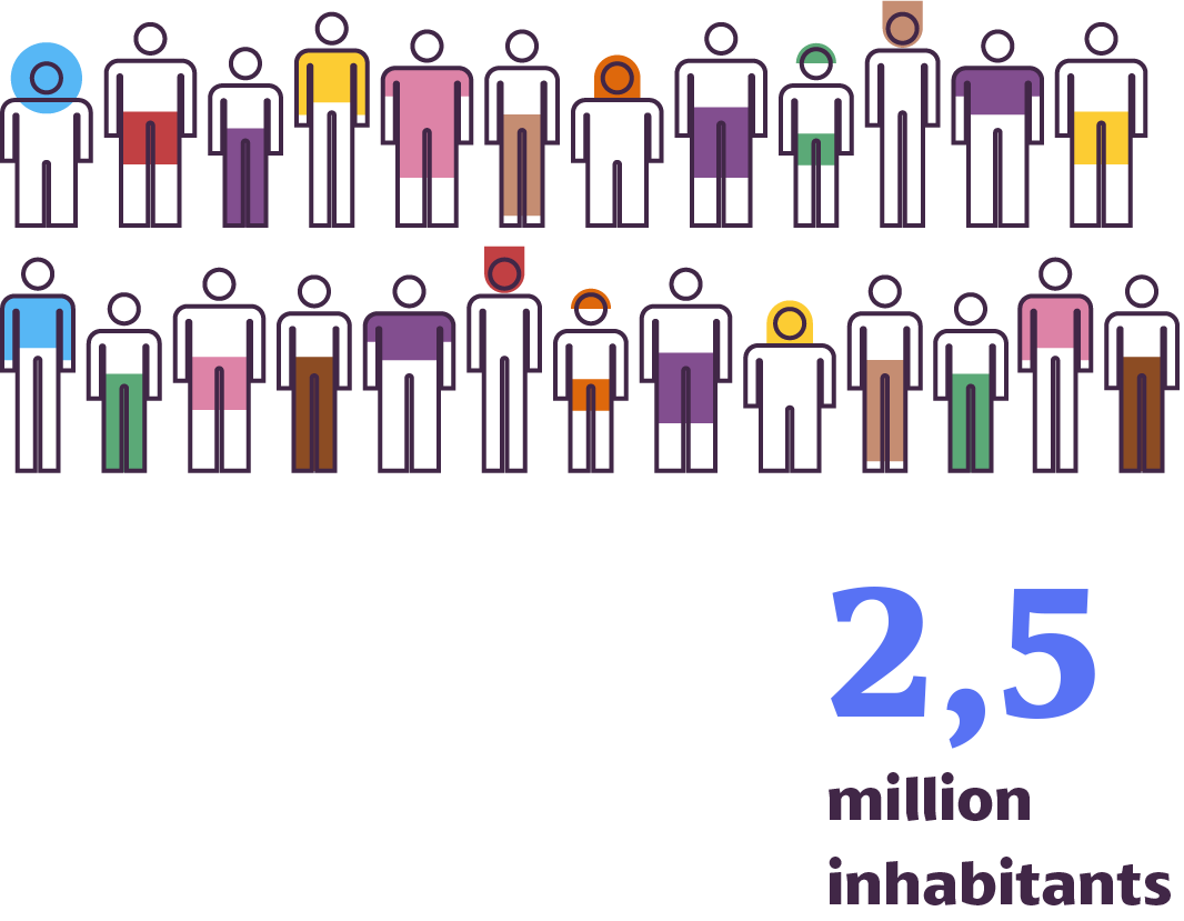
The population of Belém and the region
Urban territories, due to their high population concentration, constitute large consumer centers, with strong influence on how food is produced and marketed. Characteristics such as culture, population size and age distribution guide the demand for food. The food choices of the populations in these areas have a direct impact on how the food is produced, marketed and priced; how many jobs and income is generated, and which are the impacts on the environment.


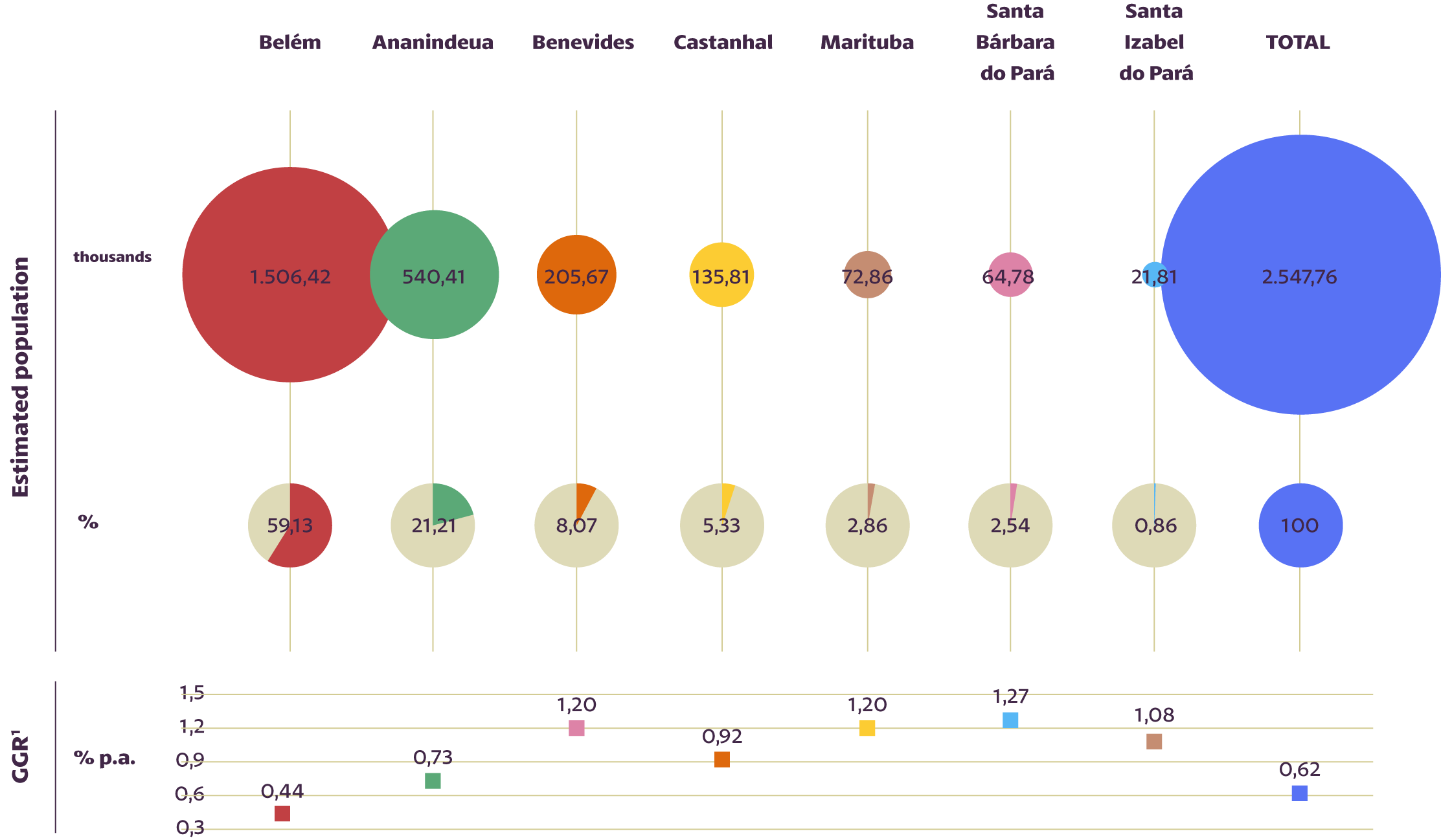

Source: IBGE, 2011
Considering age and gender groups, the distribution of the population is quite similar to the rest of the country, with 58% of the population of Belém comprising the economically active age span (20 to 59 years).
{{cada.name}}

Food economics
Metropolitan Area
(BMA) contributed with 28% to the GDP of
the state of Pará (BRL 55 billion).
alone, generated
18% of the state GDP and 66% of the Metropolitan Area, totaling
BRL 32 billion.
The service sector had the largest stake in value addition to the GDP, both in the BMA (63%) as in the municipality of Belém (67%). On the other hand, the agriculture and livestock sector contributed with only 0.3% to the GDP of the capital city, Belém.
However, significant differences arise when we look at the contribution of the sector to the GDP of other municipalities of the Belém Metropolitan Area. In Castanhal, Santa Bárbara do Pará, and Santa Izabel do Pará, which are municipalities that supply the BMA, the value aggregated by the agricultural and cattle farming sector represent 4%, 5% and 14% of the respective municipal GDPs.
industry, trade and
food services in the
BMA accounted for
jobs
in 2020
population in the BMA


{{cada.name}}
As can be seen from the graph below, people aged between 25 and 49 years comprise most of the labor force, not only in the agrifood segment, but also in the remaining sectors.
{{cada.name}}
Data from the Ministry of Economy (ME) for the municipality of Belém show that the Agrofood segment employs only 5% of the total number of jobs, generating 2.2% of the city’s total wage bill. In relation to the wage distribution in the agribusiness segment itself, the greatest increases are observed in the industrial and service sectors, with a consistent reduction in the agricultural sector over the years.
{{cada.name}}
The profile of establishments in the agrifood sector varies greatly between municipalities, the metropolitan area, and the state. In the case of the first two, the services and trade sectors prevail, followed by the industrial sector. In the case of the state of Pará, the primary sector prevails.
{{cada.name}}

Land use in Belém
has an area of
1,059 km2

Expansion entailed, especially by the occupation of
forest areas (65,3%), fields (21,5%) and pasture areas (11,7%).
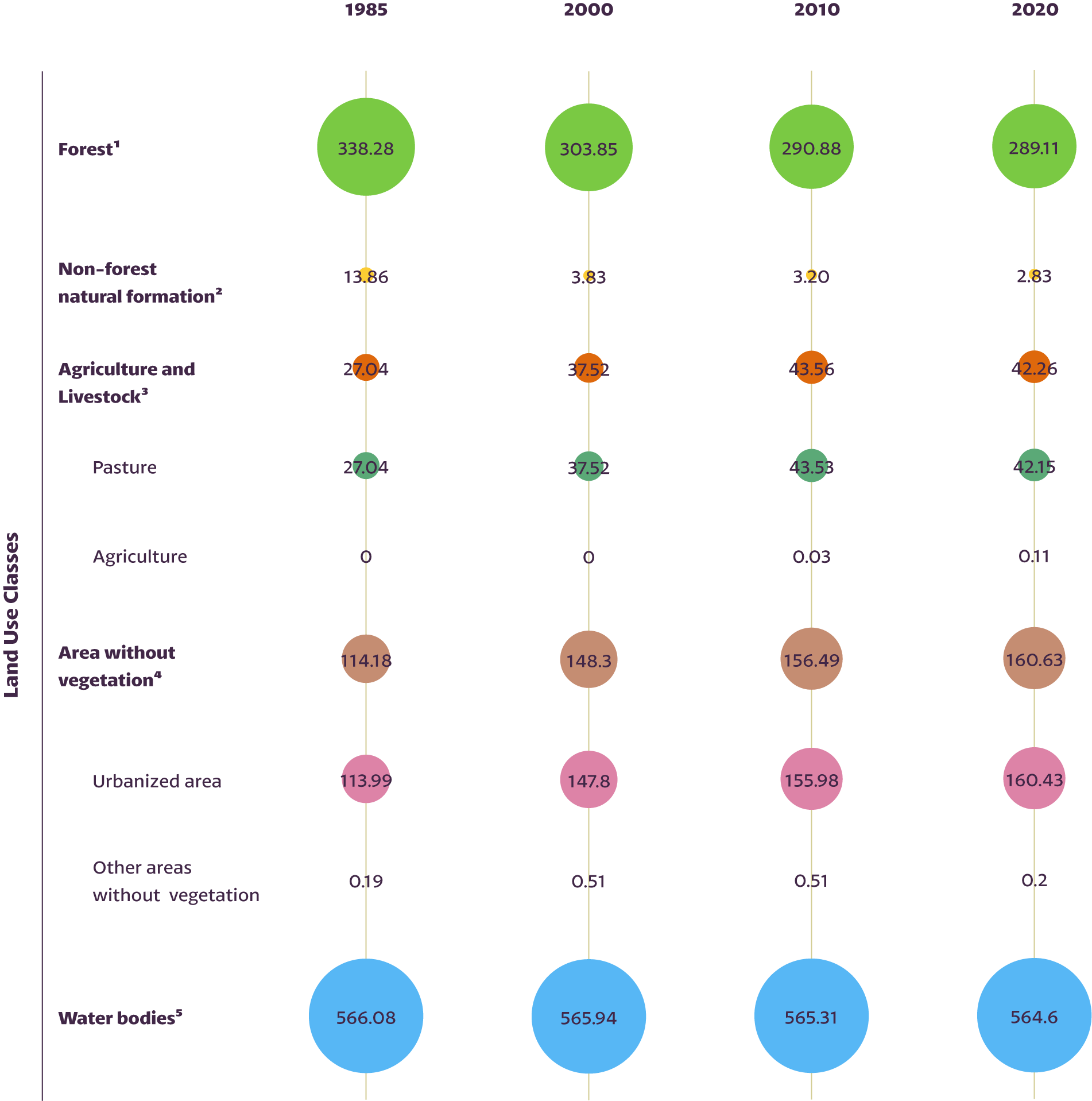


2 Grassland and salt flat (apicum);
3 Pasture and agriculture;
4 Beaches, dunes and other areas without vegetation;
5 River, lake and ocean.
The municipality of Belém has two environmental protection areas and four parks with specific land use rules for the conservation of the natural vegetation.
to visualize the dynamics
of land use in Belém.


Food consumption

The average food expenses in the Belém Metropolitan Area (BMA) consumed 20% of the family budget in the years 2017-2018. Among the poorer family, with monthly per capita income of BRL 355, this percentage reached 28%.

On average, 27% of food expenses in the BMA occur outside of the domicile – which is below the national average (33%). Among the poorest, this rate drops to 9%. Among the richer population, with a monthly per capita income of BRL 3,828, this rate rises to 38%.
Regional products such as açaí, manioc flour, and fish have a large weight in family expenditures on food in the BMA, if compared to the same average expenditures in Brazil. On the other hand, families in the BMA spend less on products such as vegetables and fruits.

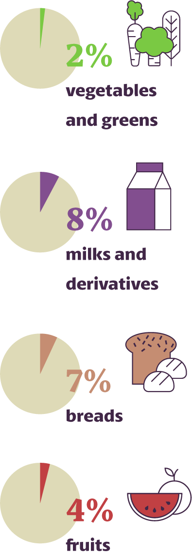
in the Belém Metropolitan Area - 2017/2018


Fish accounts for about 12% of the total food costs and 48% of expenses with meats, entrails and fish. In Brazil, these values are 5% and 24% respectively.

Fish accounts for about 12% of the total food costs and 48% of expenses with meats, entrails and fish. In Brazil, these values are 5% and 24% respectively.

Fish accounts for about 12% of the total food costs and 48% of expenses with meats, entrails and fish. In Brazil, these values are 5% and 24% respectively.

Food security

A population with food security is one with regular and permanently ensured access to quality food, in sufficient quantity without compromising the need of other essential resources.
In 2018, more than half of the population of the Belém Metropolitan Area (BMA) was in a situation of food insecurity, varying between severe, moderate or light. The data surveyed also show that the problem is greater in the BMA than in other metropolitan areas of the country.
Brazil, Belém Metropolitan Area (BMA) and other Metropolitan Regions (MRs) - 2017/2018**
{{cada.name}}
Available at: https://www.ibge.gov.br/estatisticas/.... Accessed on: 08 Sep. 2022.
* Brazilian food insecurity scale.
** Percentages may not add 100% due to rounding errors.
Income and food prices are very important aspects when the issue is food security. There is a significant inequality in the BMA: in 2018, for instance, the 20% wealthier had a monthly per capita income 10.8 times above that of the 20% poorer population.


Additionally, since 2006, food prices in the BMA increased above the national average, with additional increase during the Covid pandemic (which started in January 2020). Considering the products of major relevance for local food consumption (açaí, flour and fish), the trend for variation and increase of the price of flour stands out.
açaí pulp in the BMA - July 2006 to November 2021.
* The value 100 was adopted for the base period (July/2006) for elaboration of food prices, showing an accrued inflation (over 100) or deflation (below 100).

Where does the food come from?
The Supply Centers of the State of Pará (CEASA/PA) are the main places for trading horticultural products from the Belém Metropolitan Area (BMA), supplying fairs and retail stores not part of large supermarket chains. From the data of the CEASA/PA, it was possible to identify where part of the food that supplies Belém and the region comes from.
of the food
traded at CEASA/PA
proceeds from other states
This stake reaches 82% when considered in monetary trade value. This impacts the price of food and increases the risk of waste generation during transportation. The supply of vegetables, a highly perishable product, would benefit greatly if demands were met by local and regional production.
(in 2021BRL), according to groups of products, from Pará and other states (2021).


(leaves, flowers
and stems)

(fruits)

(roots, tubercles
bulb and rhizomes)

products

View %
View absolute values
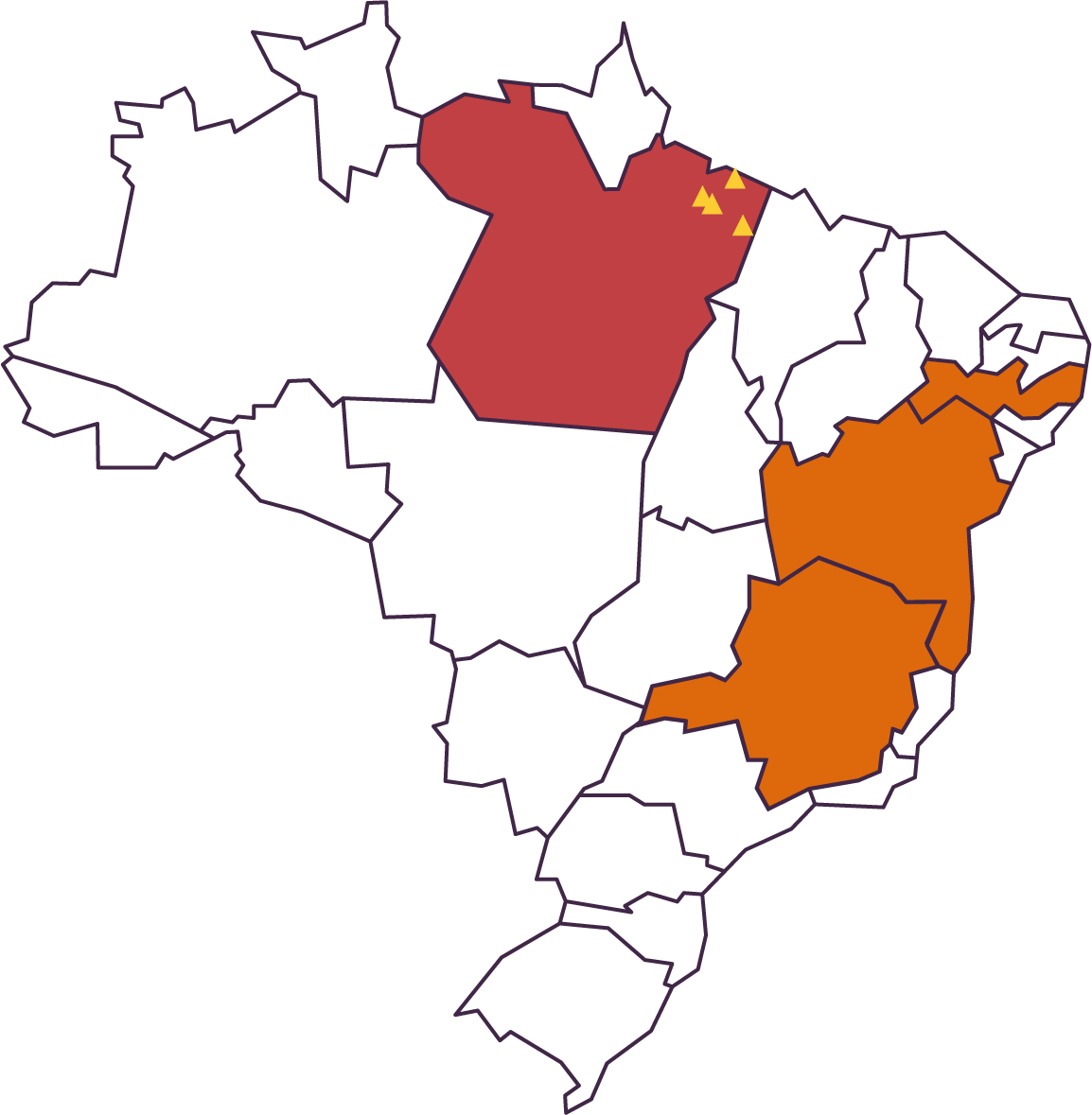
M = MillionThe states of Pernambuco, Minas Gerais and Bahia are the main food providers for CEASA/PA. On average, these foods travel 2,000 km to reach Belém. Except for the state of Tocantins, no other state of the North region supplies any product to CEASA/PA, thus emphasizing the reliance of road transport to supply the region.
{{cada.name}}
of the total amount traded
at CEASA/PA comes from
the production of the state of Pará
The municipalities in the state with the largest participation in the total value of products marketed at the trade post: Capitão Poço (27%), Santo Antônio do Tauá (15%), Curuçá (7%) and Santa Izabel do Pará (6%).

Food marketing
The circulation of food in the city of Belém uses different marketing channels: markets, supermarkets, wholesale and retail chains, ports, markets, public fairs and Supply Centers of the State of Pará (CEASA).
The large wholesale and retail chains – of local, regional or national origin – have their own channels for supplying their stores, marketing products even from other regions of the country.
In 2019, the Federal Government's Annual Social Information Report (RAIS) counted

295 establishments
linked to
wholesale trade

970 establishments
linked to
the retail trade
in Belém
ports

managed by the Municipal Economy Secretariat of Belém (SECON)
- Icoaraci Pier
- Port of Feira do Açaí
- Port of Ver-o-Peso
- Port of Palha
- Port of Açaí
- Port of Sal
- Port of Praça Princesa Isabel
Some of these ports feature wholesale product markets, especially fish and açaí, coming from the islands near Belém; from other municipalities and even other states, such as from the state of Amapá.
The network of markets and public fairs is very relevant for the city’s food supply, both for fresh and processed products.Many of the fairs in Belém are more than 30 years old, which shows their relationship with the organization of urban space.

Fairs constitute prominent food purchasing sites in the BMA, representing 11% of the population's purchase habit. In Brazil as a whole, this figure is only 4%.
purchase habit
this figure is only4%
{{cada.name}}
Available at: https://www.ibge.gov.br/estatisticas/.... Accessed on: 08 Sep. 2022.
Presently, the city of Belém has 17 public markets and 32 regular fairs.
public markets
traders

regular fairs
traders
The public markets in Belém have a significant relevance in the fish, meat and poultry trade.
the Township recorded
2.8 million
kilos of fish sold in these
spaces.

visualize the physical location of these
establishments in the region of Belém.


